The archipelago nation of the Philippines is a land of breathtaking beauty, rich culture, and a history deeply intertwined with the powerful forces of nature. Situated squarely within the notorious Ring of Fire, a horseshoe-shaped belt known for its intense seismic activity and frequent volcanic eruptions, the Philippines has faced an unending historical narrative of earthquakes and volcanic eruptions Philippines history. These natural phenomena have not merely been background events; they have profoundly shaped the nation’s landscape, architecture, economy, culture, and the very fabric of its society. From ancient times witnessed by indigenous communities to the modern era of scientific monitoring and disaster response, the story of Philippine history natural disasters is one of repeated devastation, remarkable resilience, and continuous adaptation.
This article delves into the long and often challenging history of the Philippines’ encounters with its volatile geology. We will explore the geological forces that make the archipelago so vulnerable, recount significant historical seismic and volcanic events across different periods – from the Spanish colonial period disasters to the American colonial period disasters and the era of Philippine independence disasters. Furthermore, we will trace the evolution of how the nation has attempted to cope, predict, and mitigate the impacts of these destructive forces, highlighting the development of institutions like PHIVOLCS and the ongoing efforts towards building disaster resilience Philippines. Understanding this history is crucial not just for appreciating the past but for informing future strategies in a country where the ground beneath is perpetually restless.
The Geological Crucible: The Philippines on the Ring of Fire
To comprehend the constant threat of Philippine seismic activity and volcanic eruptions, one must first understand the archipelago’s precarious geological positioning. The Philippines lies at the complex collision zone of several major tectonic plates, primarily the Pacific Plate and the Philippine Sea Plate subducting beneath the Eurasian Plate. This convergence creates intense geological stress, resulting in a landscape riddled with active fault lines Philippines and a chain of active volcanoes.
Plate Tectonics and Philippine Vulnerability
The Ring of Fire is a direct consequence of plate tectonics. The Earth’s lithosphere is broken into massive plates that are constantly, albeit slowly, moving. Where these plates converge, one often slides beneath the other in a process called subduction. This subduction zone is a hotbed for geological activity. Magma generated by the melting of the subducting plate rises to the surface, forming volcanic arcs, and the immense friction and pressure build-up are released as earthquakes.
The Philippines is surrounded by subduction zones, including the Manila Trench to the west, the Philippine Trench to the east, and the East Luzon Trough. The archipelago itself is fragmented by numerous active fault systems, most notably the Philippine Fault Zone, a major strike-slip fault extending the length of the country. The interaction of these plates and fault systems makes the Philippines one of the most seismically active and volcanically prone regions on Earth. This inherent geological instability means that historical seismic events and historical volcanic events are not anomalies but integral parts of the nation’s past.
Major Fault Systems and Volcanic Arcs
The fault lines Philippines are critical indicators of where future earthquakes might occur. The Philippine Fault Zone, stretching over 1,200 kilometers, is capable of generating powerful tremors. Other significant fault systems crisscross the islands, including the Marikina Valley Fault System near Metro Manila, posing a direct threat to the capital region.
The volcanic activity is equally significant. The country is home to over 300 volcanoes, of which at least 24 are considered active. These volcanoes form distinct arcs, such as the Bicol Volcanic Arc and the Central Luzon Volcanic Arc. Iconic and frequently active volcanoes like Mayon Volcano history, Taal Volcano history, and Mount Pinatubo are constant reminders of the powerful forces at play beneath the surface. The history of their eruptions constitutes a major part of the volcanic eruptions Philippines history.
Understanding these geological fundamentals is the necessary foundation for appreciating the historical challenges the Philippines has faced in “battling” these formidable natural forces.
Historical Impacts: Pre-Colonial and Colonial Eras
Long before the arrival of European colonizers, indigenous communities in the Philippines lived in harmony, albeit a precarious one, with their geologically active environment. While detailed written records from the pre-colonial period are scarce, archaeological evidence and oral traditions suggest that early Filipinos developed building techniques adapted to seismic activity and held beliefs that incorporated the power of volcanoes and earthquakes.
Early Accounts and Indigenous Responses
Historical accounts from the early Spanish period sometimes mention existing structures that, perhaps inadvertently, possessed some degree of earthquake resistance, often utilizing lighter materials like bamboo and nipa that were less prone to catastrophic collapse compared to heavy stone structures. Indigenous knowledge likely included observations of natural signs that might precede eruptions or tremors, informing evacuation or precautionary measures rooted in generations of lived experience. While not “scientific” in the modern sense, these early responses demonstrate an understanding of living within a dynamic landscape. The concept of disaster resilience Philippines has roots in these early adaptive behaviors.
Spanish Colonial Period: Disasters and Early Documentation
The arrival of the Spanish in the 16th century brought centralized administration, larger stone structures like churches and government buildings, and crucially, written records. These records provide the first detailed accounts of major Philippine earthquakes and volcanic eruptions, particularly their devastating impact on colonial settlements like Manila.
The Spanish colonialists, accustomed to a geologically stable Europe, were often caught unprepared by the intensity and frequency of these events. Manila earthquakes history is particularly poignant, as the city, the center of Spanish power, was repeatedly damaged or destroyed. Notable events include:
- 1600: A strong earthquake caused significant damage in Manila.
- 1645: A massive earthquake, estimated to be one of the strongest in Philippine history, devastated Manila, killing thousands and destroying many stone buildings. This event highlighted the vulnerability of European-style construction to Philippine seismic conditions.
- 1762: During the British Occupation of Manila, an earthquake added to the city’s woes.
- 1863: A powerful earthquake struck Manila, collapsing the Manila Cathedral and killing hundreds during a service. This event was a catalyst for the implementation of early building regulations aimed at making structures more resistant to seismic shaking.
- 1880: A series of strong earthquakes hit Luzon, causing widespread damage in Manila and surrounding provinces. This sequence of tremors was particularly alarming and led to increased scientific interest and the establishment of seismic monitoring efforts.
The Spanish colonial period disasters forced a grudging adaptation. Authorities began to mandate changes in construction, promoting the use of lighter materials for upper stories and designing buildings with earthquake resistance in mind, leading to the development of the bahay na bato style with its sturdy ground floor and lighter upper levels.
Notable Seismic/Volcanic Events in the Spanish Period
| Year | Event Type | Location/Impact | Significance |
|---|---|---|---|
| 1600 | Earthquake | Manila | Early recorded major seismic event impacting the capital. |
| 1641 | Volcanic Eruption | Mount Parker (Mindanao) | Major eruption with widespread ashfall and impact. |
| 1645 | Earthquake | Manila and Luzon | Devastating, led to significant loss of life and property. |
| 1754 | Volcanic Eruption | Taal Volcano (Batangas) | One of Taal’s most violent and longest eruptions, destroying towns. |
| 1814 | Volcanic Eruption | Mayon Volcano (Albay) | Mayon’s deadliest eruption, burying the town of Cagsawa. |
| 1863 | Earthquake | Manila and Luzon | Destroyed Manila Cathedral, prompted building code changes. |
| 1880 | Earthquakes | Luzon (Series of tremors) | Intense seismic activity, spurred scientific monitoring. |
Export to Sheets
These events demonstrated the immense destructive power of nature and highlighted the need for better understanding and preparation, setting the stage for future developments in disaster response Philippines history.
American Colonial Period: Scientific Monitoring and Early Infrastructure
The American colonial period, beginning in 1898, brought a more systematic and scientific approach to understanding and responding to natural disasters. While still suffering from significant events, this era saw the establishment of institutions and infrastructure that laid the groundwork for modern seismic monitoring Philippines and hazard assessment.
One key development was the establishment of the Manila Observatory, initially founded by the Jesuits during the Spanish era, which significantly expanded its meteorological and seismological studies under American administration. Figures like Fr. Miguel Saderra Masó and later, Fr. William Repetti, were pioneers in Philippine seismology, meticulously documenting earthquake occurrences and attempting to understand their patterns. Early seismic instruments were introduced, marking a shift towards a data-driven approach.
Infrastructure development during this period, while primarily serving economic and military purposes, also had implications for disaster resilience. Ports, roads, and communication lines, though vulnerable, facilitated response efforts after events. The Americans also continued and refined building codes, incorporating lessons learned from past earthquakes to construct more resilient public buildings.
Significant events during this period include:
- 1911: The catastrophic eruption of Taal Volcano, killing over 1,300 people, primarily due to the resulting tsunami-like waves within the caldera lake and base surges. This eruption was a stark reminder of the specific hazards posed by certain Philippine volcanoes.
- 1949: The eruption of Mount Hibok-Hibok in Camiguin, initially characterized by dome growth, culminated in a deadly pyroclastic flow in 1951, killing hundreds. This event highlighted the need for effective hazard communication and evacuation protocols.
The American colonial period disasters spurred a greater understanding of the scientific basis of these phenomena and the importance of systematic observation and data collection. This era transitioned the country’s approach from primarily reactive and religiously framed responses to one beginning to incorporate scientific analysis and preventative measures.
Timeline: Key Developments in Disaster Response/Monitoring (Spanish to American)
- 1863: Post-earthquake building code revisions in Manila (Spanish Period).
- 1865: Founding of the Manila Observatory by Jesuits, initially focused on meteorology but soon including seismology.
- Late 19th Century: Increased focus on earthquake recording and study by Manila Observatory (Spanish/American Transition).
- Early 20th Century: Expansion of Manila Observatory’s seismological network and research under American administration.
- 1911: Taal eruption leads to increased study of volcanic hazards.
- 1930s-1940s: Continued refinement of building codes based on seismic data.
Major Disasters of the 20th Century and Beyond
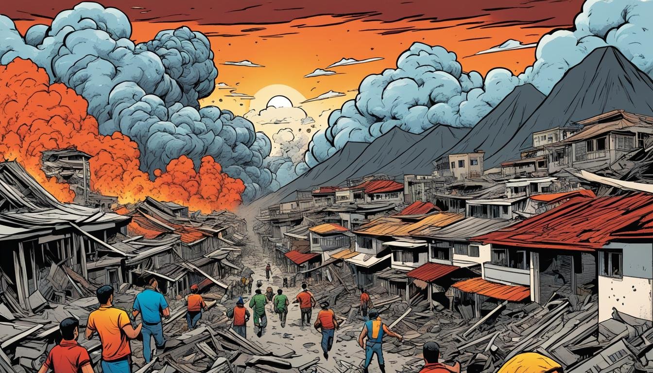
The post-independence era of the Philippines has unfortunately been marked by a series of highly destructive major Philippine earthquakes and volcanic eruptions. These events, often occurring in a more populated and developed nation, have resulted in significant loss of life, widespread damage, and profound socio-economic impacts, further shaping the trajectory of disaster response Philippines history.
The Luzon Earthquake of 1990
One of the most devastating seismic events in recent memory was the Luzon earthquake of 1990. On July 16, 1990, a magnitude 7.8 earthquake struck Central Luzon, with its epicenter near Rizal, Nueva Ecija. The earthquake caused liquefaction, landslides, and the collapse of buildings across a wide area, including Baguio City, Cabanatuan City, and Dagupan City.
The images of collapsed hotels and schools in Baguio, the collapsed Christian College of the Philippines in Cabanatuan, and the submerged streets of Dagupan due to liquefaction were seared into the national consciousness. The earthquake resulted in over 1,600 fatalities and caused billions of pesos in damage to infrastructure and property.
The 1990 Luzon earthquake exposed significant vulnerabilities in building practices and urban planning. It underscored the critical need for stricter enforcement of building codes and better preparedness measures, particularly in areas susceptible to liquefaction and landslides.
The Eruption of Mount Pinatubo (1991)
Following closely on the heels of the Luzon earthquake, the Pinatubo eruption 1991 was one of the largest and most significant volcanic events of the 20th century globally. After decades of dormancy, Mount Pinatubo in Central Luzon showed signs of unrest in early 1991. PHIVOLCS, the Philippine Institute of Volcanology and Seismology (established in 1984, evolving from earlier geological survey efforts), played a crucial role in monitoring the volcano and issuing timely warnings.
Despite the earthquake in 1990, the Pinatubo eruption presented a different, though equally formidable, challenge. The climactic eruption on June 15, 1991, coincided with a typhoon, exacerbating the impact. The eruption produced massive pyroclastic flows, lahars (volcanic mudflows), and ejected a vast amount of ash into the atmosphere, affecting global temperatures.
While the eruption itself directly caused relatively few deaths due to successful evacuations coordinated by PHIVOLCS and local authorities, the subsequent lahars were devastating, burying towns and infrastructure for years. The ashfall affected agricultural lands, disrupted air travel, and caused roofs to collapse. The Pinatubo eruption highlighted the complex nature of volcanic hazards, extending beyond the immediate eruption to long-term secondary effects like lahars. It also showcased the vital importance of scientific monitoring and effective hazard communication in saving lives.
Recent Significant Seismic and Volcanic Events
The early 21st century has seen a continuation of significant historical seismic events and volcanic activity in the Philippines.
- 2013 Bohol Earthquake: A magnitude 7.2 earthquake struck the island of Bohol in the Visayas region, causing widespread destruction, including the collapse of historical churches and significant ground deformation. The earthquake highlighted the vulnerability of historical structures and the need for localized disaster response capabilities.
- Series of Mindanao Earthquakes (2019-2020): Mindanao experienced a series of strong earthquakes, including magnitudes 6.6 and 6.9, causing damage and displacement in several provinces. These events underscored the seismic risk in the southern Philippines and the importance of preparedness in all regions.
- Taal Volcano Eruption (2020): Taal Volcano, one of the Philippines’ most active and complex volcanoes, had a short but explosive eruption in January 2020, generating an ash column and causing the evacuation of hundreds of thousands of people from surrounding areas. This event demonstrated the continued threat posed by volcanoes located near densely populated areas and tested the nation’s updated evacuation protocols.
These recent events serve as stark reminders that the battle against natural disasters in the Philippines is ongoing and requires continuous vigilance, adaptation, and investment in preparedness and disaster mitigation Philippines.
Evolution of Disaster Response and Preparedness
The cumulative experience of centuries of battling earthquakes and volcanic eruptions has fundamentally shaped the Philippines’ approach to natural disasters. There has been a significant shift from reactive responses often rooted in religious interpretations to a more proactive, scientifically informed, and institutionally driven system.
From Religious Intervention to Scientific Approach
In the early colonial period, major disasters were often interpreted through a religious lens, seen as divine punishment or trials. Responses often involved prayers, processions, and appeals for divine intervention. While faith remains an important source of comfort, the understanding and response to disasters have increasingly become grounded in scientific inquiry and empirical observation.
The work of early seismologists and volcanologists, particularly during the American period and gaining momentum in the post-independence era, was crucial in this transition. The systematic collection of data on seismic events and volcanic activity provided the basis for identifying hazards, understanding their mechanisms, and developing predictive capabilities, however limited.
Establishment of PHIVOLCS and Disaster Agencies
A key milestone in the evolution of disaster response Philippines history was the formalization of government agencies dedicated to natural hazards. The Philippine Weather Bureau, established during the American period, included seismological observations. This function was later transferred and expanded, eventually leading to the creation of the Philippine Institute of Volcanology (PHIVOLC) in 1952, which was later reorganized and renamed the Philippine Institute of Volcanology and Seismology (PHIVOLCS) in 1984.
PHIVOLCS is now the primary government agency responsible for monitoring earthquakes and volcanoes, conducting research, and disseminating hazard information. Its network of seismic stations and volcano observatories across the country provides the critical data needed for issuing warnings and advising authorities and the public.
Beyond PHIVOLCS, the nation has developed a multi-layered disaster risk reduction and management (DRRM) system. The National Disaster Coordinating Council (NDCC) was the precursor to the current National Disaster Risk Reduction and Management Council (NDRRMC), established under the Philippine Disaster Risk Reduction and Management Act of 2010 (Republic Act 10121). This law shifted the focus from a reactive disaster response to a more proactive, comprehensive approach encompassing preparedness, mitigation, response, and rehabilitation. Local government units (LGUs) are mandated to establish their own DRRM councils and offices, bringing disaster mitigation Philippines efforts closer to the communities at risk.
Development of Building Codes and Infrastructure Resilience
Lessons learned from devastating earthquakes, particularly the 1968 Casiguran earthquake and the 1990 Luzon earthquake, have driven the continuous evolution of building codes in the Philippines. The National Structural Code of the Philippines (NSCP) incorporates seismic design provisions aimed at ensuring that buildings can withstand expected ground shaking.
While enforcement remains a challenge, the intent is to improve the earthquake-resistant construction Philippines history. Modern infrastructure projects are designed with seismic considerations, though retrofitting older, vulnerable structures remains a significant task in building disaster resilience Philippines. The historical narrative shows a clear progression from rudimentary adaptations to increasingly sophisticated engineering standards.
Community-Based Disaster Risk Reduction
Recognizing that national agencies and building codes are only part of the solution, there has been a growing emphasis on community-based disaster risk reduction (CBDRR). This approach empowers local communities to assess their own risks, develop preparedness plans, conduct drills, and establish early warning systems tailored to their specific vulnerabilities, whether from volcanic hazards Philippines or seismic ones.
CBDRR initiatives are crucial in translating scientific information from agencies like PHIVOLCS into actionable steps at the grassroots level. This includes educating residents about volcanic hazards Philippines associated with nearby volcanoes or the potential impacts of fault lines Philippines running through their areas.
Socio-Economic and Cultural Impacts
The recurring natural disasters have left indelible marks on the socio-economic and cultural landscape of the Philippines. The history of these events is not just a chronicle of geological activity but also a narrative of human struggle, loss, recovery, and the forging of a resilient spirit.
Reconstruction and Recovery Efforts
Following major earthquakes or eruptions, the immediate aftermath is invariably focused on search and rescue and providing relief to affected populations. However, the long-term challenge lies in reconstruction and recovery. Rebuilding homes, infrastructure, schools, and businesses is a monumental task that can take years or even decades, placing immense strain on national and local resources.
The Pinatubo eruption 1991, for instance, displaced tens of thousands of people and required massive rehabilitation efforts to rebuild communities buried by lahars and restore agricultural lands. The Luzon earthquake of 1990 necessitated extensive reconstruction in urban centers like Baguio and Cabanatuan. These recovery processes highlight both the generosity of domestic and international aid and the logistical complexities of rebuilding in disaster zones.
Displacement and Livelihoods
Natural disasters often lead to mass displacement. People are forced to evacuate their homes, sometimes permanently, becoming internally displaced persons. This displacement disrupts livelihoods, particularly for communities reliant on agriculture, fishing, or tourism in affected areas.
Volcanic eruptions can render vast tracts of land unusable due to ashfall or pyroclastic deposits. Earthquakes can destroy infrastructure essential for economic activity. The history of earthquakes volcanic eruptions Philippines history is also a history of communities forced to relocate, adapt new ways of earning a living, and cope with the psychological trauma of losing their homes and familiar surroundings.
Cultural Narratives and Memory of Disasters
Natural disasters are woven into the cultural fabric and collective memory of the Filipino people. They are recounted in stories, songs, and local histories. Historical churches and buildings that have withstood or been rebuilt after earthquakes stand as testaments to both vulnerability and resilience. The ruins of the Cagsawa church tower, partially submerged by the 1814 Mayon eruption, is a powerful visual symbol of nature’s destructive power and the enduring spirit of the community.
These shared experiences of coping with natural hazards have fostered a sense of community solidarity and a cultural emphasis on bayanihan (communal help) during times of crisis. While the scientific understanding has grown, elements of respect, awe, and sometimes fear towards the powerful forces of nature remain part of the cultural psyche. The historical narrative of battling these disasters contributes to the unique identity and resilience of the Filipino nation.
The Ongoing Challenge and Future Outlook
Despite significant progress in scientific understanding, monitoring capabilities, and disaster management frameworks, the Philippines remains highly vulnerable to earthquakes and volcanic eruptions. The increasing population density in urban areas and along coastal zones further amplifies the potential impact of future events.
Current State of Seismic Monitoring Philippines
PHIVOLCS operates a nationwide network of seismic stations that continuously monitor ground shaking. This network allows for the rapid detection and location of earthquakes, enabling the issuance of earthquake bulletins and tsunami warnings when necessary. Research into active fault lines Philippines continues to improve hazard mapping and assessment.
However, challenges remain, including the need for more dense seismic networks in certain areas, updating aging equipment, and ensuring the sustainability of monitoring efforts. Public awareness and preparedness drills remain crucial, as early warnings for earthquakes are often not possible due to their sudden nature. The focus for seismic hazards is largely on preparedness, building resilience, and effective response.
Volcanic Hazards and Alert Systems
PHIVOLCS also maintains a close watch on the country’s active volcanoes, utilizing a range of monitoring techniques including seismic monitoring, ground deformation measurements, gas analysis, and visual observations. A multi-level alert system is in place for active volcanoes, providing guidance to local authorities and the public on the current level of unrest and necessary precautions or evacuation orders.
Understanding volcanic hazards Philippines – including pyroclastic flows, lahars, ashfall, and volcanic gases – is critical for effective preparedness. While monitoring technology has improved, predicting the exact timing and intensity of volcanic eruptions remains complex. The history of events like the Pinatubo eruption highlights the importance of combining scientific data with proactive risk management.
Towards Greater Disaster Resilience Philippines
Building genuine disaster resilience Philippines requires a multi-faceted approach that goes beyond just monitoring and response. It involves:
- Strengthening Building Codes and Enforcement: Ensuring that all new constructions adhere to the latest seismic and wind load standards and addressing the vulnerability of existing structures through retrofitting programs.
- Improving Land Use Planning: Avoiding or limiting development in high-hazard zones (e.g., active fault lines, volcano danger zones, areas prone to liquefaction or landslides).
- Investing in Resilient Infrastructure: Designing and building critical infrastructure like roads, bridges, hospitals, and schools to withstand expected levels of seismic shaking and other hazards.
- Enhancing Early Warning Systems: Continuously improving the accuracy, timeliness, and reach of early warning systems for tsunamis, lahars, and volcanic eruptions.
- Strengthening Community Preparedness: Sustaining and expanding community-based initiatives, education campaigns, and regular drills to ensure that citizens know how to respond before, during, and after a disaster.
- Promoting Research and Innovation: Supporting scientific research to better understand Philippine geology, improve prediction models, and develop innovative solutions for disaster risk reduction.
- Addressing Climate Change Impacts: Recognizing that climate change may exacerbate certain hazards, such as increasing the intensity of rainfall that triggers lahars or landslides.
The historical journey of the Philippines in battling natural disasters has been one of continuous learning and adaptation. While the geological threats persist, the nation has moved from a position of vulnerability and limited understanding to one of increasing scientific capacity and a more structured approach to disaster risk reduction. The lessons of past major Philippine earthquakes and volcanic eruptions Philippines history serve as invaluable guides for navigating the challenges that lie ahead.
Key Takeaways:
- The Philippines’ location on the Ring of Fire makes it highly susceptible to earthquakes and volcanic eruptions.
- Historical accounts from the Spanish colonial period provide the first detailed records of devastating natural disasters, particularly in Manila.
- The American colonial period saw the introduction of more scientific methods for monitoring seismic and volcanic activity.
- Major events like the 1990 Luzon Earthquake and the 1991 Pinatubo Eruption significantly shaped modern Philippine disaster response policies.
- The establishment of PHIVOLCS is a key development in the country’s ability to monitor and understand geological hazards.
- Philippine disaster management has evolved from a reactive stance to a more comprehensive approach focused on preparedness, mitigation, response, and rehabilitation.
- Building codes, infrastructure resilience, and community-based initiatives are crucial components of the ongoing effort to build disaster resilience.
- Natural disasters have had profound and lasting socio-economic and cultural impacts on the Philippines.
- Despite progress, the challenge of managing geological hazards remains significant, requiring continuous investment and adaptation.
Frequently Asked Questions (FAQ):
Q1: Why does the Philippines experience so many earthquakes and volcanic eruptions? A1: The Philippines is located on the Pacific Ring of Fire, a zone of intense seismic and volcanic activity caused by the collision of tectonic plates, specifically the Philippine Sea Plate and the Pacific Plate subducting beneath the Eurasian Plate. This geological setting creates numerous active fault lines and volcanoes throughout the archipelago.
Q2: What is PHIVOLCS and what is its role? A2: PHIVOLCS stands for the Philippine Institute of Volcanology and Seismology. It is the primary government agency in the Philippines responsible for monitoring earthquakes and volcanic activity, conducting research on geological hazards, and providing timely and accurate information to the public and authorities to aid in disaster preparedness and response.
Q3: What were some of the most significant natural disasters in Philippine history? A3: Several events stand out, including the devastating 1645 Manila Earthquake, the 1754 Taal Volcano eruption, the 1814 Mayon Volcano eruption (which buried Cagsawa), the 1990 Luzon Earthquake, and the 1991 eruption of Mount Pinatubo. These historical seismic events and historical volcanic events caused immense destruction and shaped the country’s approach to disaster management.
Q4: How did the Spanish colonial period deal with earthquakes? A4: Initially, responses were often reactive and religiously framed. However, repeated devastating earthquakes, particularly in Manila, led to the implementation of early building regulations, promoting the use of lighter materials for upper stories and influencing architectural styles to improve earthquake-resistant construction Philippines history.
Q5: How has disaster response in the Philippines evolved over time? A5: Disaster response has evolved significantly from primarily reactive, and sometimes religiously interpreted, measures to a more scientific, proactive, and institutionalized approach. The establishment of agencies like PHIVOLCS and the NDRRMC, the development of hazard mapping, early warning systems, stricter building codes, and a focus on disaster mitigation Philippines and community-based preparedness mark this evolution.
Q6: What are lahars and why are they a major volcanic hazard in the Philippines? A6: Lahars are destructive mudflows or debris flows composed of volcanic material, rock fragments, and water. They can occur during an eruption or long after, triggered by heavy rainfall mixing with loose volcanic deposits. Lahars are a major volcanic hazards Philippines because they can travel far from the volcano, burying communities and infrastructure, as seen most dramatically after the Pinatubo eruption 1991.
Q7: How does the Philippines work towards building disaster resilience? A7: Building disaster resilience Philippines involves multiple strategies, including improving seismic monitoring Philippines and volcanic surveillance, strengthening building codes, developing and enforcing land-use plans that avoid high-hazard zones, investing in resilient infrastructure, conducting public awareness campaigns and drills, and promoting community-based disaster risk reduction initiatives.
Sources:
- Philippine Institute of Volcanology and Seismology (PHIVOLCS) Official Website. (Provides current monitoring data, hazard maps, and historical information on earthquakes and volcanoes). [Likely URL: www.phivolcs.dost.gov.ph]
- National Disaster Risk Reduction and Management Council (NDRRMC) Official Website. (Details the current disaster management framework and historical reports). [Likely URL: www.ndrrmc.gov.ph]
- Bankoff, G. (2003). Constructing sustainable livelihoods: Vulnerability and resilience in the Philippines. Disasters, 27(3), 186-201. (Academic paper discussing vulnerability and resilience from a historical perspective).
- Newhall, C. G., & Punongbayan, R. S. (Eds.). (1996). Fire and mud: eruptions and lahars of Mount Pinatubo, Philippines. Philippine Institute of Volcanology and Seismology, Quezon City, and University of Washington Press, Seattle. (Definitive work on the 1991 Pinatubo eruption).
- Peterson, J. A. (2006). Earthquake and fire: An island history of the 1863 and 1880 Manila earthquakes. Journal of Historical Geography, 32(3), 633-650. (Focuses on historical Manila earthquakes).
- Oppenheimer, C. (2011). Eruptions That Shook the World. Cambridge University Press. (Includes discussion of major Philippine eruptions like Pinatubo).
- Historical texts and archives detailing the Spanish and American colonial periods in the Philippines, often found in national libraries or archives. (Specific titles would vary depending on the collection).
- Academic articles and books on the history of science and seismology in the Philippines.
(Note: Specific URLs for historical texts might vary or require library access. The provided URLs for PHIVOLCS and NDRRMC are the likely official sites.)